Public Involvement
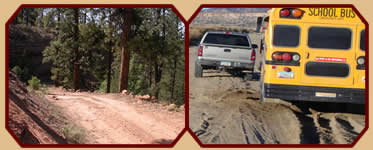
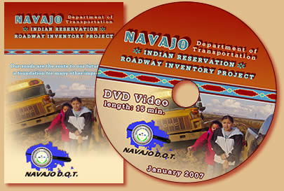
The DTS/Eagle Point Team personnel produced a 15-minute video designed to inform the Navajo people about the Roadway Inventory Project and how it will benefit the Navajo Nation. The DTS/Eagle Point Team worked closely with the Navajo DOT as they completed all phases of the video production including: on-site video of the Navajo Nation, interviews, editing, music selection, and script content. The video includes statements about the project from Navajo DOT personnel and other officials, speaking in both English and Navajo languages.
500 DVDs were delivered for distribution. A trailer of the video was shown at the Navajo Nation Fair and will be shown in all chapterhouses throughout the Navajo Nation.
|
|
The DTS/Eagle Point Team also produced 40,000 full-color brochures to help orient the Navajo People to the Roadway Project.
Again, The DTS/Eagle Point Team worked closely with Navajo DOT on their needs for the brochure, creating it to express the message Navajo DOT thought was most clear and beneficial.
In addition, The DTS/Eagle Point Team personnel helped to brainstorm on how to reach the public by radio, ads and other media.
|
GIS Data Creation
As the project began, it became clear that a new, accurate centerline would be critical to success.
The DTS/Eagle Point Team acquired 2006 one-meter digital orthophotos from the States of Arizona, Utah, and New Mexico for the extraction effort.
To date, all roads have been extracted for Arizona and New Mexico.
The Utah imagery was recently delivered and extraction should be complete by the end of February. This new road network will be the base for future transportation management activities. |
|
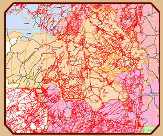
The red lines represent a portion of Navajo roads that The DTS/Eagle Point Team has digitized.
|
RIFDS
The DTS/Eagle Point Team automated the generation of strip maps based on Geographic Information Systems (GIS) data and information within the Road Inventory Field Data System (RIFDS).
The initial application was created to automate the production of over 2700 sections. The tools developed for this effort will be part of the final deliverable to Navajo DOT which will streamline the submission of required roadway information. |
|
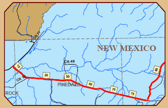
Example section of Route 001 Strip Map.
|
 |
|
|